Measuring Up: How Big Is the United Kingdom Really
When comparing the visual size of countries in a blog post, it’s crucial to use the same map projection, such as the Mercator projection, for consistency and accuracy. Different projections distort sizes and shapes in various ways, so using the same projection ensures that all countries are subject to the same type of distortion.
This uniformity is essential for making valid comparisons. The Mercator projection, in particular, is known for its rectangular representation, which makes it easier to compare countries side by side. However, it’s important to note and acknowledge the limitations of this projection, especially its tendency to exaggerate the size of regions closer to the poles while minimizing those near the equator.
With that out of the way … let’s go!
The United Kingdom is comprised of four countries: England, Scotland, Wales, and Northern Ireland. Here’s a comparison of their sizes and the percentage they contribute to the total area of the UK:
- England:
- Size: Approximately 130,279 square kilometers.
- Contribution to UK’s total area: Roughly 53.6%.
- Scotland:
- Size: About 78,387 square kilometers.
- Contribution to UK’s total area: Roughly 32.3%.
- Wales:
- Size: Around 20,779 square kilometers.
- Contribution to UK’s total area: About 8.6%.
- Northern Ireland:
- Size: Nearly 13,843 square kilometers.
- Contribution to UK’s total area: Around 5.7%.
England is the largest, contributing over half of the UK’s total area, while Northern Ireland is the smallest. Scotland, despite its size, contributes significantly, followed by Wales.
The size of Russia compared to the United Kingdom
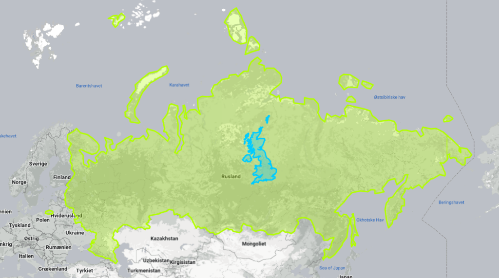
The UK’s total area is 242,900 square kilometers, and its land area is 241,930 square kilometers.
Russia, the world’s largest country, stands at a massive 17,098,242 square kilometers in total area and 16,376,870 square kilometers in land area. This makes Russia approximately 70 times larger than the UK in terms of total area and about 68 times larger in terms of land area.
The size of Canada compared to the United Kingdom
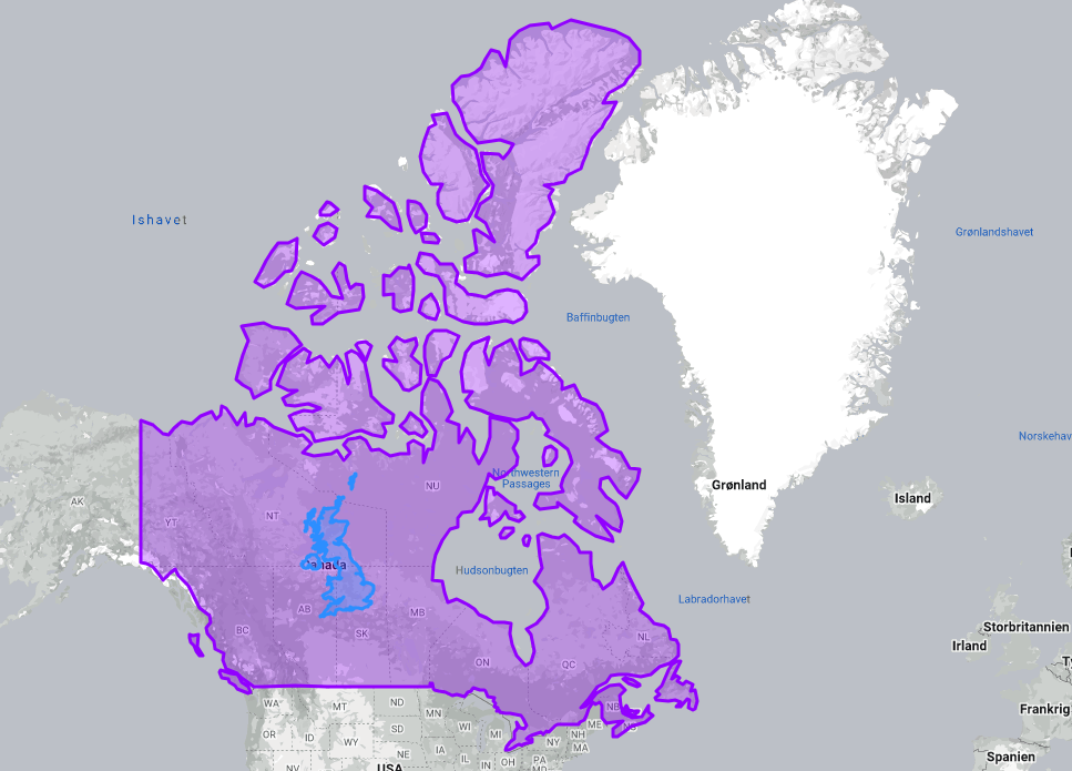
Canada has a total area of 9,984,670 square kilometers and a land area of 9,093,510 square kilometers. This makes Canada approximately 41 times larger than the UK in terms of total area and about 38 times larger in terms of land area.
The size of New Zealand compared to the United Kingdom
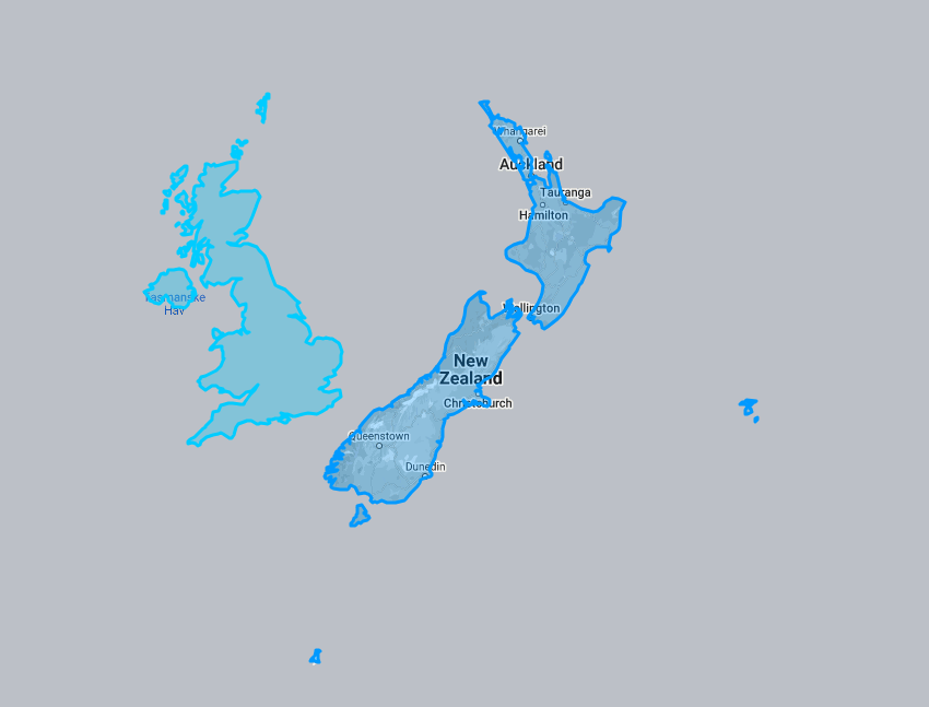
New Zealand’s total area is 270,467 square kilometers, and its land area is 263,310 square kilometers. This means New Zealand is slightly larger than the UK, with its total area being about 1.1 times that of the UK and its land area also approximately 1.1 times larger. This comparison illustrates how New Zealand, often perceived as a small country, is quite comparable in size to the UK.
The size of Romaina compared to the United Kingdom
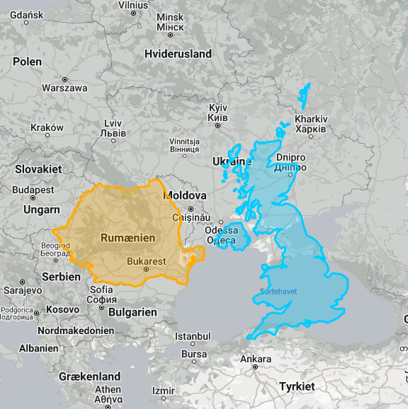
Romania has a slightly smaller land area of 230,170 square kilometers. This makes the two countries relatively close in size, with the UK being only marginally larger in terms of both total and land area.
