Some childhood memories just refuse to fade. And paper folding is definitely one of them. Creating a boat or an airplane from a page torn from a notebook used to be a simple pleasure of life for so many of us. Daniel and Nina at MapScaping are no different. So they thought: how about we make those memories all the more sweet by fusing it with the one thing we are so passionate about now – maps!
PRESENTING, DO-IT-YOURSELF PAPER GLOBES:
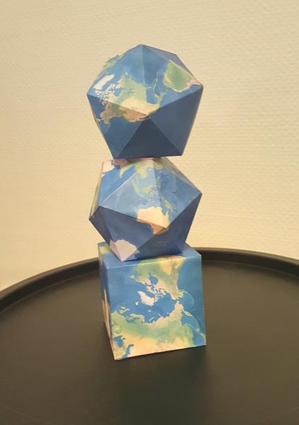
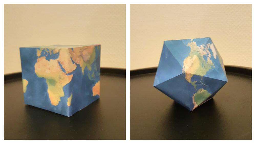
Notice how they didn’t stop at just one shape. There are 12 different ready-to-fold and assemble 3D globes – each conjuring into a shape more awesome than the other.
Here’s a fun fact: These paper globes have been created using real topographic data. Which means if you fold it up just right, you will get a geographically accurate globe. We can almost envision the smiles this activity is going to bring to a geography teacher’s classroom.
But, of course, these 3D paper globes are not just a great teaching resource. Geogeeks can turn them into a fun family project or use them as a part of GIS Day (November 14) celebrations. They can also be used as a decoration item for home or office, or to gift to someone who loves to travel.
Here’s what you need to do:
- Go to Folding Paper Globes page on MapScaping and click on the image you like
- You will redirected to printable a PDF file of that image
- Take a colored printout on size A3 paper. (A4 works too, but it isn’t as much fun – especially with, well, big fingers)
- You will find that each fold has been marked with a thin black line
- That’s it. Get folding!
Pro tip: For more complicated designs, you can use a ruler to make sure you are getting a clean and precise fold.
And if you know someone who is as passionate about geography and maps as we are, spread some love by sharing this post with them.
